

By SUZANNE DOWNING
Sept. 16, 2026 – A twin-engine air taxi carrying eight people continued its descent below the minimum altitude for landing at Cape Newenham before crashing into rising terrain in dense fog, according to a preliminary report released by the National Transportation Safety Board.
The Aug. 20 crash killed both pilots and all six passengers aboard the Cessna 441 operated by Security Aviation. The Anchorage-based flight was attempting to land at the Cape Newenham Long Range Radar Station airport in Southwest Alaska.
The NTSB report did not determine a probable cause, a finding that will come later in the investigation.
According to the report, the airplane departed Ted Stevens Anchorage International Airport at 9:11 am for the flight to Cape Newenham. Weather at the destination deteriorated significantly during the trip.
The crew first entered a holding pattern near the airport while waiting for conditions to improve. At 10:43 am, the airport’s automated weather system reported visibility of one-quarter mile in patches of fog, with an overcast ceiling just 300 feet above the ground.
The pilots began their first instrument approach shortly after 11 am but abandoned it and executed a missed approach. They told air traffic control that they were in visual weather conditions and canceled their instrument flight clearance.
A technician stationed at Cape Newenham told investigators that the crew then said it would attempt to land at Platinum, about 23 miles north. Several minutes later, however, the crew contacted the Cape Newenham technician again and said it had been unable to reach anyone at Platinum by radio and wanted to make a second approach to Cape Newenham.
By then, the technician said, fog had obscured all visibility reference points around the airport. He could no longer see the runway.
The pilots contacted Anchorage air traffic controllers again at 11:24 am and requested clearance for a second approach. During the approach, the airport weather system was reporting one-quarter-mile visibility, fog and an overcast ceiling at 300 feet.
The published instrument approach required at least three miles of visibility and established a minimum descent altitude of 1,320 feet. The approach chart also warned that the runway sits on the slope of a 2,306-foot mountain, with high terrain on both sides and beyond the south end.
“Successful go-around improbable if initiated past the MAP,” the chart cautioned, referring to the missed-approach point.
Preliminary flight-tracking data showed the airplane crossed the missed-approach point at about 1,000 feet — already below the published minimum descent altitude — and continued toward the runway while descending to about 600 feet.
The last tracking data was recorded at 11:43:51 am, when the airplane was approximately 1.3 miles north of the runway threshold.
The Cape Newenham technician told investigators that he heard what sounded like normal engine noise as the airplane approached. He then heard the engines throttle up, followed by what he described as a “backfire.” The sound then stopped, he told the NTSB.
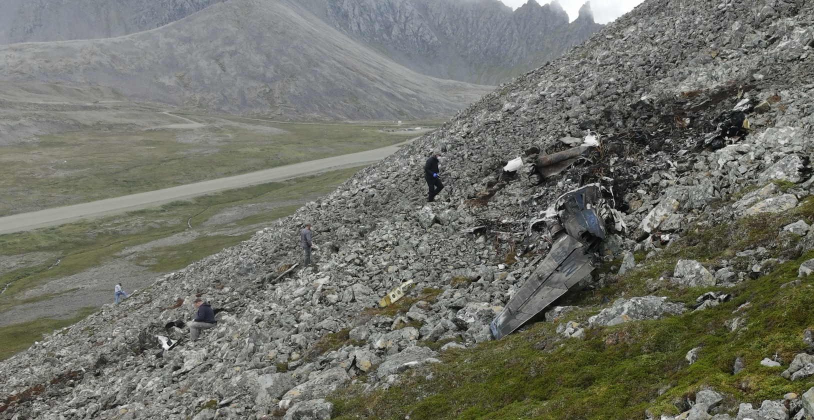
The wreckage was found in rising terrain about one-half mile west of the approach end of the runway.
Investigators determined that the airplane first struck rocky terrain at an elevation of about 610 feet. The debris path extended approximately 160 feet uphill, with pieces of the wings, fuselage, propeller blades, flaps and ailerons scattered along the path. The main wreckage came to rest on its left side, and evidence of a post-crash fire was found at the site.
A technician had inspected the runway earlier that morning and found no obstructions or wildlife. He was unable to conduct the customary second inspection before the airplane’s arrival because thick fog had blanketed the runway.
At 11:49 am, minutes after the crash, the airport reported one-quarter-mile visibility, an overcast ceiling at 300 feet and a temperature and dew point both at 10 degrees Celsius — conditions consistent with fog.
The aircraft was destroyed. The wreckage is awaiting recovery to a secure location for a more detailed examination.
The Federal Aviation Administration, Security Aviation, Textron Aviation, Honeywell Aerospace, the US Air Force and air traffic controllers’ representatives are participating in the investigation.
The NTSB emphasized that its report is preliminary and that the information may change as the investigation continues.
The report is here:


3 thoughts on “NTSB: Cape Newenham plane continued below minimum altitude before fatal crash”
Very sad story. The radar technician didn’t hear a “backfire.” He heard the plane impacting the mountain. I’ll speculate here: the instrument approach standards did not allow a landing. So the pilots attempted a visual landing but never saw the runway, or saw that they were off course. At the last minute they throttled up to full power, pulled up and vectored to the west in an effort to escape the boxed-in landing strip. They crashed 600 feet up the mountain side about 1/4 mile west of the airport (NTSB report). They committed to a landing strip that they never saw for alignment. They couldn’t escape the high walls of the mountain. RIP all.
[…] NTSB: Cape Newenham plane continued below minimum altitude before fatal crash […]
On a good day, Newenham is a tough approach and landing strip. If it’s fogged-in, you do not attempt to land. As the written standard stated, “improbable,” lived up to its word. The passengers and crew did not.