

By SUZANNE DOWNING
Sept. 10, 2026 — On this day in 1899, one of the most powerful earthquakes ever recorded in North America struck the Yakutat Bay region, lifting part of Alaska’s coastline nearly 48 feet and sending destructive waves through bays and coastal communities.
The magnitude 8.6 earthquake struck at 21:41 UTC, shortly after noon by local solar time, on Sept. 10, 1899. It was the largest shock in a remarkable series of earthquakes that rattled the region throughout September of that year.
The area was sparsely populated and much of it had not been mapped in detail, but the physical changes left by the earthquake were so immense that they remained unmistakable when a US Geological Survey team arrived six years later.
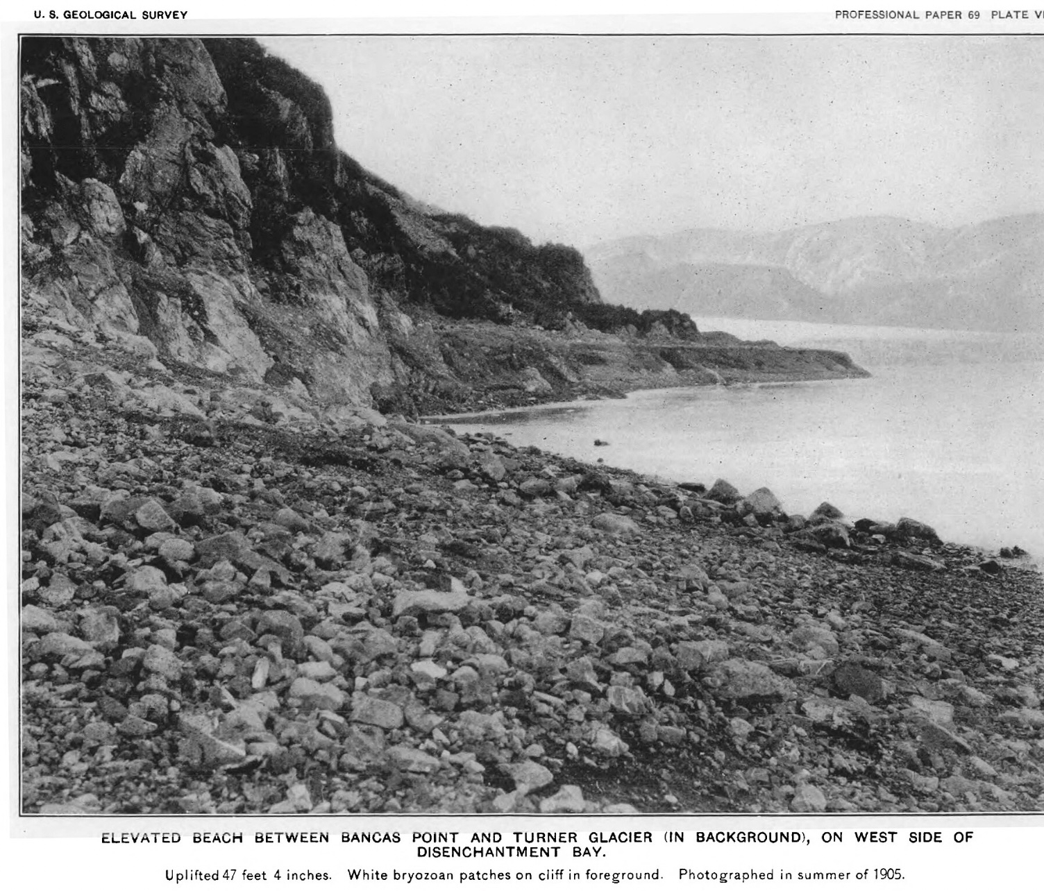
Along the west coast of Disenchantment Bay, the land rose as much as 14.5 meters, or about 47.5 feet. Beaches that had been underwater were suddenly high and dry. Dead barnacles and shellfish marked former shorelines far above the new tide level.
Uplift of at least 16 feet affected a broad area. New reefs appeared in Disenchantment Bay, and small islands emerged along the eastern side of Yakutat Bay.
Haenke Island, about 30 miles north of Yakutat, rose between 17 and 19 feet. The upheaval added an estimated eight or nine acres to the island.
Other sections of the coast moved in the opposite direction. Parts of Knight Island, Khantaak Island and the mainland immediately north of Yakutat sank by as much as six feet. Salt water flooded areas of trees, and a cemetery on Khantaak Island was submerged.
The earthquake also fractured the ground along Nunatak Fiord, where investigators later documented a vertical displacement of nearly eight feet.
Prospectors camped near Disenchantment Bay reported feeling more than 50 shocks on Sept. 10 alone. Two were described as particularly violent. During the strongest shaking, men reportedly could not remain standing and held onto tent poles to keep from being thrown to the ground.
At Yakutat village, residents felt repeated shocks and described two as severe. More than 10 earthquakes were felt at a U.S. Coast and Geodetic Survey camp near Point Whitshed by the Copper River Delta. Shaking was also reported in the Chugach Mountains, along the Yukon River in Canada, and in Juneau and Skagway.
People ran into the streets in Juneau, roughly 210 miles southeast of Yakutat. Reports of shaking came from as far away as the Birch Creek gold district northeast of present-day Fairbanks.
The earthquake generated multiple tsunamis, some caused directly by the sudden movement of the land and others by underwater and mountainside landslides.
Three waves about 15 feet high arrived at Yakutat at intervals of approximately five minutes. Witnesses reported that the bay filled with whirlpools, lumber and driftwood. A sawmill chute was caught in one whirlpool and torn away.
The damage could have been far worse. The waves reached Yakutat during low tide.
On the western side of Yakutat Bay, water climbed as high as 30 feet and uprooted trees. Elsewhere in the bay, tsunami runup reached approximately 35 feet.
Separate landslide-generated waves were reported across a wide stretch of coastal Alaska. A four-foot wave traveled up the Bering River near Katalla, while a seven-foot wave struck Valdez. At Glacier Bay, earthquake-triggered ice collapse sent waves across the water and capsized boats more than a mile from the glacier face.
The shaking was so powerful that waves were observed on the Yukon River near Whitehorse, roughly 180 miles northeast of Yakutat. A probable seiche — a wave sloshing within an enclosed body of water — was reported on Lake Chelan in Washington, approximately 1,100 miles away.
The earthquake also changed the behavior of glaciers. Avalanches dumped enormous amounts of snow, rock and ice onto their upper reaches. In later years, at least nine glaciers around Yakutat Bay advanced as that material slowly moved toward the coast.
Other glaciers reacted differently. The shattering of Muir Glacier contributed to a rapid release of icebergs and the later retreat of that and other ice tongues in Glacier Bay.
Despite the extraordinary changes to the landscape, structural damage was relatively limited because so few people lived in the affected region at the time. A few of the houses were damaged at Dry Bay. A log cabin north of Yakutat was destroyed, and another at Dalton House in the Yukon was shaken so severely that it was considered unsafe. Machinery overturned at a salmon cannery in Dundas Bay. No deaths were recorded.
The 1899 earthquake occurred decades before Alaska had modern seismic instruments, communications systems or emergency-warning networks. There are no photographs or videos of the actual occurrence. Scientists reconstructed much of the event from eyewitness accounts, raised beaches, drowned forests, fault scarps and other evidence.
Their findings were published in 1912 in The Earthquakes at Yakutat Bay, Alaska, in September, 1899, a landmark U.S. Geological Survey report by Ralph S. Tarr and Lawrence Martin.