


A burst of seismic activity rattled Alaska and the Yukon on Saturday morning, as seven earthquakes struck within just over 20 minutes across a wide swath of the region. The Alaska Tsunami Center has not issued a tsunami warning or advisory.
The rapid sequence, beginning with a powerful initial magnitude of 6.8, was felt from Burwash Landing in the Yukon to Yakutat, Skagway, and beyond, although much of the outer coast is uninhabited.
The US Geological Survey adjusted the magnitude to 7.0.
Update: The location has been adjusted to 154 miles west of Whitehorse, Yukon Territory, Earthquakes Canada reports, which is about 88.5 miles north of Yakutat.
The initial quake, a 7.0 event at 11:41 am AKST, struck 56 miles south of Burwash Landing in Yukon Territory, according to the Alaska Earthquake Center. Residents across the border in Alaska reported strong shaking from the deep, sizeable quake.
Five minutes later, at 11:46 am, a magnitude 5.6 earthquake hit 53 miles north of Yakutat, followed by a magnitude 5.3 quake at 11:51 a.m., also north of Yakutat, just 55 miles from the community. Yakutat to the southwest of Burwash Landing, which is closer to Cordova. But since the quake was centered south of Burwash, it was closer to the same latitude as Yakutat.
The ground continued to move in the minutes that followed. At 11:54 am., a magnitude 4.6 occurred 51 miles south of Burwash Landing, and at 11:57 am, a magnitude 4.3 struck 49 miles southwest of Burwash Landing, indicating significant movement along the same general seismic zone.
Two smaller events may have closed out the cluster. At 12:03 pm, a magnitude 4.4 struck 61 miles northeast of Icy Bay, and at exactly the same minute, a magnitude 3.5 earthquake was recorded 9 miles southeast of Tyonek on Cook Inlet, right across from Anchorage.
There were no immediate reports of major damage or injuries, but the tightly timed sequence reinforces Alaska’s position as one of the most seismically active regions in the world.
On Dec. 2, the Alaska Earthquake Center wrote about the Denali Fault in the area:
“The Denali Fault is a major intracontinental right-lateral strike-slip fault that partially accommodates the oblique collision of the Yakutat block into Alaska’s margin, extending from northwestern British Columbia to the central and western regions of Alaska. The largest earthquake recorded on the Denali Fault was a M7.9 on November 3, 2002. Its rupture extended for nearly 270 miles (435 km) along the central Denali Fault system. This event was preceded by the M6.7 Nenana Mountain Earthquake on October 23, which ruptured 25 miles (40 km) of the Denali Fault west of the M7.9 event. It is typical behavior of these major right-lateral faults in the Interior to produce very low background levels of seismicity between large ruptures hundreds of years apart that are followed by multi-year aftershock sequences. Another notable feature associated with the Denali Fault system is the Kantishna seismic cluster, located just north of the main fault trace inside Denali National Park. This cluster produces tens of small, shallow earthquakes every day. The largest known earthquakes in this cluster are on the order of magnitude 5, but those are rare. This cluster is believed to accommodate deformation between the Denali Fault and the Minto Flats Seismic Zone to the north.”
Geologists would be currently reviewing the events to determine how they may be related and whether they represent aftershocks, triggered movement, or coincidental activity across multiple faults. This story may be updated.
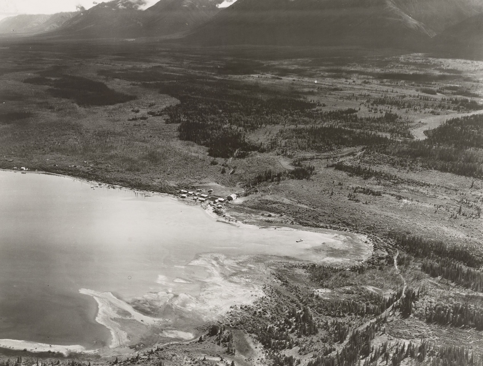
Photo at top: Historic photo of Burwash Landing, Yukon Territory.


2 thoughts on “Series of strong earthquakes rattle southern coast near Yakutat, Icy Bay”
The only thing that makes the natural occurrences of earthquakes, tornados. volcanic eruptions and sleeping volcanos waking up, hurricanes is its occurrences are closer together and frequent, and strengthening just as Revelations, Old Testament, the apostle Paul and John had warned When Christ second coming is right around the corner.
The Jews didnt expect Jesus to come as he did the first time, just like the world isn’t expecting Christ to come Eventhough when Jesus was born there was a Magnificent star 🌟 to tell of the event and angels visiting a group of hillbilly shepards after disturbing them with a brilliant display of worship
The Earth 🌍 knows when its LORD and creator is coming, and when HE does come, it’ll be louder than the first and All will know!
How do we all respond when we know our boss or employer is coming down the hall? Exactly! That would be how to earth would respond everything gets a wave of electric charge intensifying in excitement just as we each stand to attention out of fear and respect for the one in charge at our workplace, the earth knows who made it.
Take a look at the UAF Seismology Lab’s interactive map of the quake. Lots and lots of aftershocks, some quite big. Rolled for a long time here in ANC. Cheers –
https://earthquake.alaska.edu/earthquakes