


By SUZANNE DOWNING
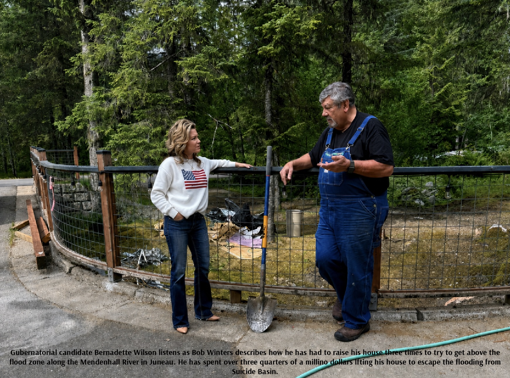
Aug. 9, 2026 – Bob and Chris Winters spent more than four decades in their home on View Drive in Juneau’s Mendenhall Valley. They intended it to be the place where they would spend their retirement.
But as Suicide Basin fills with meltwater above the city once again, the Winters are preparing for another round in a long battle against the Mendenhall River.
Bob Winters, a marine pilot, has had their home raised repeatedly over the years in an effort to keep it above the floodwaters. The home now sits about nine feet higher than it once did, on top of a tall concrete foundation with a long staircase now leading to its entrance. The couple has also raised the driveway and garage by several feet.
View Drive is a low-lying, dead-end road along the Mendenhall River. The neighborhood experienced flooding before the recent series of record glacial lake outburst floods, but the annual releases from Suicide Basin have made the danger more frequent and severe.
The Winters say they first contacted the city about their flooding concerns around 2014, when water rose more than three feet in their garage and about 10 inches entered their house. Flooring and walls were damaged.
They responded by spending their own money to elevate the property, but even that has not ended the threat.
During the record 2023 outburst, View Drive was cut off by floodwater. Water contaminated by fuel and debris entered homes in the neighborhood. Residents used boats to reach their properties.
The 2025 flood brought another record crest. While temporary HESCO barriers protected hundreds of properties elsewhere in the Mendenhall Valley, View Drive remained outside the main protected corridor. Several feet of water entered some homes along the street, utility and communication services were disrupted.
Now, another possible release is approaching. Perhaps as early as this week.
The National Weather Service reported that Suicide Basin was at an estimated elevation of about 1,343 feet in its latest update, only seven feet below the approximately 1,350-foot elevation of the basin’s overflow channel. Water had already begun expanding into that channel.
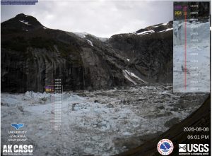
The basin had been rising at about two feet per day, although the rate slowed somewhat late last week. Forecasters said the most likely time for the basin to become full was Aug. 10-11.
A full basin does not necessarily mean an immediate flood. In previous years, the main subglacial release has taken as long as six days to begin after the basin reached capacity. Once the release starts, however, floodwater typically reaches Mendenhall Lake within one to two days.
That leaves residents only a short period to evacuate, move belongings and protect their homes.
Suicide Basin is a side basin of Mendenhall Glacier where snowmelt and rainwater collect behind an ice dam. When pressure becomes great enough, the water can force its way beneath or through the glacier, releasing billions of gallons into Mendenhall Lake and the Mendenhall River.
The basin has produced outburst floods nearly every year since 2011. The events of 2023, 2024 and 2025 successively pushed the river to record levels, causing erosion, destroying structures and flooding hundreds of homes.
The Mendenhall River reached 16.65 feet during the Aug. 13, 2025, event, surpassing the 15.99-foot record set in 2024. Another basin release in September 2025 resulted in minor flooding.
Conditions downstream are more favorable this year than they were before last year’s record event. Mendenhall Lake was around 3.3 feet in the latest report, compared with nearly nine feet before the 2025 outburst, when an atmospheric river had already pushed the lake close to minor flood stage.
But the eventual severity will depend on how much water Suicide Basin holds and how quickly it drains. Researchers use cameras, laser instruments and drone surveys to estimate the basin’s elevation and volume, but floating icebergs and the constantly changing glacier make forecasting difficult.
Juneau officials and the US Army Corps of Engineers have reinforced temporary Hesco barriers elsewhere in the valley, distributed sandbags and updated evacuation maps. But View Drive remains one of the most difficult areas to protect because of its low elevation, unstable soils, proximity to the river and lack of space for a large barrier system.
A federal buyout has been discussed as a possible long-term answer for View Drive residents. The city has explored using the Natural Resources Conservation Service’s Emergency Watershed Protection program to acquire vulnerable properties.
For the Winters, a buyout would mean abandoning the house they have lived in since the early 1980s, and walking away from the hundreds of thousands of dollars and labor they have invested in lifting it above successive floods.
Officials are also studying a more ambitious proposal known as a “lake tap,” which would use a tunnel or controlled drainage system to prevent Suicide Basin from filling to catastrophic levels. Such a project, if determined to be technically and financially feasible, remains years away.
For now, the Winters and their neighbors are watching the basin fill again.
Their situation is especially stark, but it is shared by families throughout the Mendenhall River flood zone: longtime homeowners waiting to learn whether this year’s water will remain contained or whether they will once again have to leave their homes and watch the river rise.
There is no indication as of Sunday that the basin’s main subglacial release had started.
The National Weather Service Suicide Basin monitoring page remains the primary source for current basin measurements, while the City and Borough of Juneau flood-preparedness page provides evacuation maps, alerts and emergency guidance.


6 thoughts on “Suicide Basin nearing capacity as Juneau’s Mendenhall Valley braces for another flood”
Attn NB3 … Seems like a future project could be appropriate thru the Corps of Engineers to help provide solutions.
I wouldn’t want the “corps of engineers” to design a go kart race track!
Floods have been happening for thousands of years. The Corps of Engineers has published flood maps for the Mendenhall River and Valley for at least sixty-five years. (I once lived in the Valley). The glacial phenomenon is somewhat new although I believe it has been recognized as a possibility for a long time.
At some point, insurance companies and local, State and federal governments should recognize it is imprudent to build houses in areas prone to flooding. It is unfair to those that act prudently to have taxpayers pay for unreasonable building decisions. Just sayin’.
JMark, let’s expand our thoughts. The voters hired representatives (voted them in). Then, the representatives hired managers and servants to implement their leadership. Then, after public hearings, they zoned the land by the river specifically for housing. Then, after more public hearings, they granted permission to developers to develop housing there. Then, every house was reviewed, approved and issued an expensive permit. Then, they inspected the construction of, and approved occupancy of, every house built with their permission. After all that government control, how could anyone have the gall to blame those who bought homes in that area in good faith? The voters are responsible for this problem because they own the actions of their elected representatives.
Saying Suicide Basin releases “billions of gallons” it’s more precisely described as 13.2-billion gallons. which is 50-million cubic meters. That volume can be described as a cube of water 1,208-ft on each side. As a reference, the Juneau Federal Building is only about 110-feet tall.
13.2 billion gallons could be drained at 170 cfs over 120 days. For comparison, the Sweetheart Lake Hydro project 2009 design documents indicate that the project is limited to 460 cfs at the powerhouse. I know earthmovers want to move dirt and miners want to blast tunnels, but why don’t we just use a siphon? #smartypantssolution